When Trail Marks and the Map Disagree
A painted blaze is not a promise. It is a claim about the ground. When that claim disagrees with the paper in your hand, the useful move is to stop—not to invent a third path through grass that has no mark at all.
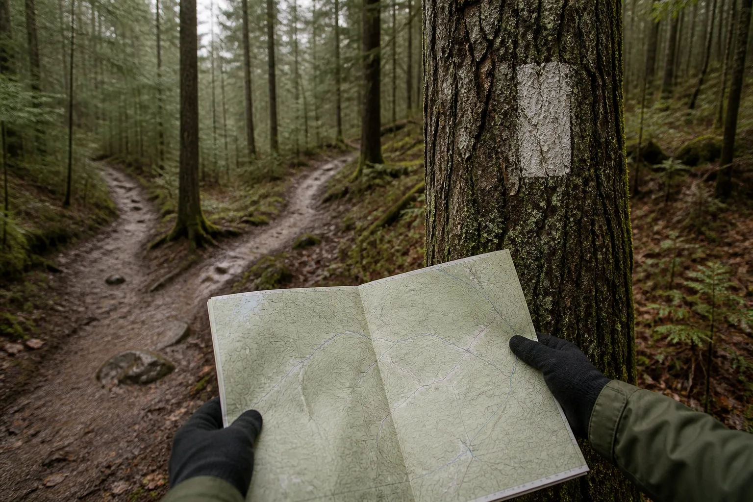
I walk a route twice before I will write about it. The first walk is for learning where the marks sit. The second is for noticing where they fail. Paint fades. Posts lean. Leaf litter covers a blaze that looked obvious last season. Leaflets stay clean long after the bark has changed. First-time walkers often trust the cleanest object in the scene—the folded map or the phone drawing—and keep moving when the ground is already telling a different story.
This note is about that moment at a fork. It is not about collecting every possible waymark system. It is about a habit: treat every post as a claim, compare it to the terrain, and reverse on the same ground when the two will not agree.
Read the post, then read the ground
Stand still long enough to do both readings. Look at the color, shape, and direction of the mark. Then look at the worn line under your feet, the slope, and whether a second faint track peels away into brush. If the mark points one way and the worn line clearly goes another, you are not “almost sure.” You are in disagreement. Disagreement is a stop signal.
Confidence is expensive here. A wrong turn taken quickly costs more time than a two-minute pause. Groups that keep walking while arguing usually invent a compromise path that nobody marked and nobody maintains.
A simple order when the signs conflict
- Stop at the fork. Do not keep drifting forward while you debate.
- Compare the mark, the map, and the worn ground as three separate claims.
- If any two disagree, treat the situation as unresolved.
- Reverse on the same path you used to arrive, unless you already hold a written backup loop.
- Do not cut through unmarked grass to “save the day.”
A shortcut without a mark saves minutes and spends hours—for you, and for the people who keep the real line open.
Why unmarked cuts feel smart and fail
Unmarked cuts look efficient because they appear to reconnect two known points. On the ground they often drop into private edges, soft banks, or drainage that looks like a path only from above. They also teach the next group that the real line is optional. Regular walkers refuse that bargain. They would rather return early with an honest unfinished ridge than arrive late by a route that never existed on any board.
- Paint can vanish between visits without updating the leaflet.
- A post can point the wrong way after weather or casual moving.
- Phone drawings lag behind temporary closures and washed-out links.
- A worn goat track is not the same as a maintained walking line.
- Standing on the mark to argue blocks people who already know the fork.
What to write into the home plan
Before you leave the house, write one sentence for mark disagreement: “If the post and the map do not match, we stop and reverse on the same ground.” That sentence belongs next to the leaving hour and the turnaround cue. It removes the need to invent ethics in the mud. Everyone in the group should be able to say it out loud.
Pair it with a backup shorter loop that stays on marked ground. The backup is not a failure plan. It is how you keep the day from turning into a scramble when the middle of the route refuses to cooperate.
How I check this in the field
On the second walk I carry the same leaflet a visitor would carry, not a private annotated copy. When I find a fade, a missing post, or a fork that only locals know, I write it as a fact in the draft. If I cannot point to the problem on the route, it does not become a heading on dacitepeak. That discipline keeps the advice from floating into general travel talk.
Weather complicates the same habit. After rain, a worn line can look like two lines, and mud can hide the blaze that confirmed the correct arm of the fork yesterday. Heat can push people to hurry past the pause they need. Wind can make a shore mark hard to hear about when the group is already split across the path. None of that changes the order: stop, compare, reverse on the same ground if the claims still refuse to match.
I also watch how groups behave at pinch points while they argue about direction. Blocking the mark to take a photograph or to hold a meeting is the local definition of rudeness. Step aside, open the map, and keep the worn line free for people who are still moving with a clear plan.
What this is not
This method does not replace local rules, visitor office notices, or advice about fitness and load. Those questions belong elsewhere. It also does not guarantee that a path will look the way it did on a previous visit. Conditions change. The point is to keep your response predictable when the marks and the map stop agreeing: stop, compare, reverse on the same ground, and protect the line you hope will still be there for the next walker.